
Clipperton Island
Population
N/A
Area
6 km²
GDP
N/A
GDP Per Capita
N/A
Background
Geography15
Location
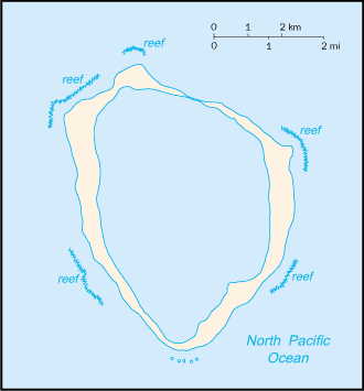
Middle America, atoll in the North Pacific Ocean, 1,120 km southwest of Mexico
Geographic coordinates
10 17 N, 109 13 W
Map references
Political Map of the World
Area
land: 6 sq km
water: 0 sq km
Area - comparative
about 12 times the size of the National Mall in Washington, D.C.
Land boundaries
Coastline
11.1 km
Maritime claims
exclusive economic zone: 200 nm
Climate
tropical; humid, average temperature 20-32 degrees Celsius, wet season (May to October)
Terrain
coral atoll
Elevation
lowest point: Pacific Ocean 0 m
Natural resources
fish
Land use
forest: 0% (2018 est.)
other: 100% (2018 est.)
Natural hazards
subject to tropical storms and hurricanes from May to October
Geography - note
the atoll reef is approximately 12 km (7.5 mi) in circumference
People & Society1
Population
Government4
Country name
conventional long form
conventional short form
local long form
local short form
former
etymology
Dependency status
possession of France; administered directly by the Minister of Overseas France
Legal system
the laws of France apply
Flag
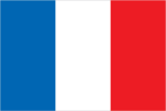
the flag of France is used
Military & Security1
Military - note
defense is the responsibility of France
Spot an error or outdated info on this page? Let us know — we usually fix it the same day.
Compare Clipperton Island
See how Clipperton Island compares to other countries side by side.
Compare Countries